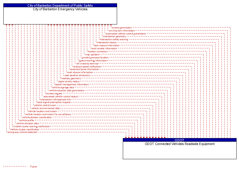
Interface: City of Barberton Emergency Vehicles - ODOT Connected Vehicles Roadside Equipment
Information Flow Definitions
access permission (Future) Selected Comm Solution
Information returned indicating whether permission for access is granted and instructions for proceeding.
access request (Future) Selected Comm Solution
Request for access to an access–controlled transportation facility.
arriving train information (Future) Selected Comm Solution
Information for a train approaching a highway–rail intersection that may include direction and allow calculation of approximate arrival time and closure duration.
automated vehicle control parameters (Future) Selected Comm Solution
Information, instructions, and control parameters for automated vehicle operations including current system conditions and advisories, control parameters (e.g., speed, required vehicle performance profiles, gaps or headways) and check in/checkout instructions.
automated vehicle control status (Future) Selected Comm Solution
Data provided by a connected vehicle identifying it's current mode and operational status and information provided to support check–in/checkout of the lane and coordinated maneuvers while on the automated facility.
incident scene warning notification (Future) Selected Comm Solution
Notification of an incident scene emergency or safety issue. This flow identifies that an incident scene emergency or safety issue has occurred so that warnings may be generated by more than one system in the work zone.
intersection geometry (Future) Selected Comm Solution
The physical geometry of an intersection covering the location and width of each approaching lane, egress lane, and valid paths between approaches and egresses. This flow also defines the location of stop lines, cross walks, specific traffic law restrictions for the intersection (e.g., turning movement restrictions), and other elements that support calculation of a safe and legal vehicle path through the intersection.
intersection infringement info (Future) Selected Comm Solution
Vehicle path information sent by a vehicle that is performing an unpermitted movement at an intersection such as a stop sign violation or running a red light. This also includes information about possible conflicts with other road users in the vehicle's path, including a range of uncontrolled intersection scenarios that could be covered by this flow. This flow does not include permanent ids; only temporary ones that allow monitoring of the vehicle as it moves across the intersection.
intersection safety warning (Future) Selected Comm Solution
A warning of an imminent unsafe vehicle infringement at an intersection that may endanger other vehicles or pedestrians. This allows vehicles approaching the intersection to be warned in the event of an imminent red light or stop sign violation or potential infringement on an occupied crosswalk. All connected vehicles and personal devices near the intersection receive the warning.
intersection status (Future) Selected Comm Solution
Current signal phase and timing information for all lanes at a signalized intersection. This flow identifies active lanes and lanes that are being stopped and specifies the length of time that the current state will persist for each lane. It also identifies signal priority and preemption status and pedestrian crossing status information where applicable.
lane closure information (Future) Selected Comm Solution
Lane closure information provided to passing vehicles. This flow provides information about roadway configuration changes such as lane closures and shifts.
local signal preemption request (Future) Selected Comm Solution
Direct control signal or message to a signalized intersection that results in preemption of the current control plan and grants right–of–way to the requesting vehicle.
local traveler information (Future) Selected Comm Solution
Traveler information including traffic, road, and weather conditions for a particular locality. This flow includes the location–specific traveler information and time effectivity of the information.
location correction (Future)
Information provided to improve positional accuracy. These corrections allow a mobile GPS receiver, such as a GPS system in a connected vehicle, to achieve a
greater absolute positional accuracy, compensating for errors that exist in satellite positioning.
map updates (Future) Selected Comm Solution
Map update that could include a new underlying static or real–time map or map layer(s) update. Map layers can include highways, major roads, streets, public transport routes, pedestrian routes, topography, points of interest, and regulatory information including turn restrictions and speed limits.
proxied personal location (Future) Selected Comm Solution
Relay of pedestrian, bicyclist, and other non–motorized user locations at an intersection. This relay or rebroadcast of personal locations supports coordination between motorized and non–motorized users that do not have interoperable communications capability.
queue warning information (Future) Selected Comm Solution
Information regarding formed or impending queues (location of the end of queue, estimated duration of the queue, and other descriptions of the queue condition) and recommendations for upstream vehicles including speed reduction, lane change, or diversion recommendations.
rail crossing warning (Future) Selected Comm Solution
A warning of a train approaching or already in a highway rail intersection.
reduced speed notification (Future) Selected Comm Solution
Reduced speed zone information provided to passing vehicles. This flow provides the reduced speed limit, the location and extent of the reduced speed zone, and associated warning information.
restricted lanes information (Future) Selected Comm Solution
This flow defines the location, duration, and operating parameters for lanes that are reserved for the exclusive use of certain types of vehicles (e.g., transit vehicles) or vehicles that meet other qualifications (e.g., number of occupants, low emissions criteria). It identifies the lane(s), the start and stop locations, start and end times, vehicle restrictions, speed limits and platooning parameters.
road closure information (Future) Selected Comm Solution
Road closure information provided to passing vehicles. This flow provides information about the road closure with diversion information.
road weather advisories (Future) Selected Comm Solution
Segment–specific weather and road conditions including real–time advisories of deteriorating road and weather conditions, medium–term advisories for the next 2–12 hours, and long–term advisories more than 12 hours into the future. The advisories may include advisories that are issued based on locally collected environmental data (e.g., an ice on bridge advisory).
roadway geometry (Future) Selected Comm Solution
The physical geometry of a road segment that specifies the location and width of each lane, including normal lanes as well as special lanes for pedestrians and bicycles, transit vehicles, and trains. This flow also may include the curvature, grade, and superelevation or banking of the road segment.
signal priority status (Future) Selected Comm Solution
In response to a request for signal priority, this flow indicates the status of the priority or preemption request.
speed management information (Future) Selected Comm Solution
Target speeds, speed advisories, and/or speed limit information provided to a vehicle. The information includes the current speed value(s), the route segment(s) and lane(s) where the speeds apply, and an indication of whether the speeds are suggested target speeds, posted advisory speeds, or enforceable speed limit values. This flow may also include information about the reason for reduced speeds and provide target lane information if lane changes are required.
vehicle cluster coordination (Future) Selected Comm Solution
Coordination between CACC–equipped vehicles that enable formation and management of strings of adjacent equipped vehicles that coordinate speed management across the string. This flow includes coordination between CACC–equipped vehicles that enable adjacent vehicles in the same lane to identify each other and couple. Depending on the CACC implementation, this flow also supports identification of the lead vehicle in the string, operating performance parameters for the string, destination information so that drivers can join strings that share their destination, and coordination so that strings of vehicles are ordered based on the individual weight and performance profile of each participating vehicle. This flow also supports dissolution of CACC vehicle strings as vehicles depart from the string.
vehicle control event (Future) Selected Comm Solution
Notification that the vehicle has performed an emergency maneuver or action that could impact the safety of surrounding vehicles. This includes hard braking and activation of traction/stability control systems or other actions that warrant immediate notification of surrounding vehicles. The information flow conveys the current vehicle location, path, and current control actions. This may also include the list of maneuvers includes lane changes/departures and overtaking/passing maneuvers.
vehicle environmental data (Future) Selected Comm Solution
Data from vehicle safety and convenience systems that can be used to estimate environmental and infrastructure conditions, including measured air temperature, exterior light status, wiper status, sun sensor status, rain sensor status, traction control status, anti–lock brake status, vertical acceleration and other collected vehicle system status and sensor information. The collected data is reported along with the location, heading, and time that the data was collected. Both current data and snapshots of recent events (e.g., traction control or anti–lock brake system activations) may be reported.
vehicle location and motion (Future) Selected Comm Solution
Data describing the vehicle's location in three dimensions, heading, speed, acceleration, braking status, and size.
vehicle location and motion for surveillance (Future) Selected Comm Solution
Data describing the vehicle's location in three dimensions, heading, speed, acceleration, braking status, and size. This flow represents monitoring of basic safety data ('vehicle location and motion') broadcast by passing connected vehicles for use in vehicle detection and traffic monitoring applications.
vehicle platoon coordination (Future) Selected Comm Solution
Coordination of control commands between leader and follower vehicles allowing vehicles to join, coordinate with, and separate from platoons of cooperative vehicles. This flow shares platoon size, location, and performance parameters (e.g., platoon speed and spacing) between platooned vehicles. It also coordinates maneuvers between platooned vehicles, including maneuvers as vehicles join and leave the platoon.
vehicle profile (Future) Selected Comm Solution
Information about a vehicle such as vehicle make and model, fuel type, engine type, size and weight, vehicle performance and level of control automation, average emissions, average fuel consumption, passenger occupancy, or other data that can be used to classify vehicle eligibility for access to specific lanes, road segments, or regions or participation in cooperative vehicle control applications.
vehicle signage data (Future) Selected Comm Solution
In–vehicle signing data that augments regulatory, warning, and informational road signs and signals. The information provided would include static sign information (e.g., stop, curve warning, guide signs, service signs, and directional signs) and dynamic information (e.g., local traffic and road conditions, lane restrictions, work zones, detours, closures, advisories, and warnings).
vehicle situation data (Future) Selected Comm Solution
This flow represents vehicle snapshots that may be provided by the vehicle to support traffic and environmental conditions monitoring. Snapshots are collected by the vehicle for specific events (e.g., when a sensor exceeds a threshold) or periodically and reported based on control parameters when communications is available. Traffic–related data includes snapshots of measured speed and heading and events including starts and stops, speed changes, and other vehicle control events. Environmental data may include measured air temperature, exterior light status, wiper status, sun sensor status, rain sensor status, traction control status, anti–lock brake status, and other collected vehicle system status and sensor information. The collected data is reported along with the location, heading, and time that the data was collected.
vehicle situation data parameters (Future) Selected Comm Solution
A request for vehicle situation data that includes parameters used to control the data that is reported and the flow of data reported by the vehicle. This flow identifies the type of data/snapshots that are requested and reporting parameters such as snapshot frequency, filtering criteria (data thresholds for reporting), and reporting interval.
wrong way vehicle detected (Future) Selected Comm Solution
Notification that a vehicle has been detected traveling in the wrong direction. This can be a direct report by an equipped vehicle that is being driven in the wrong direction or a report of a non–equipped vehicle that has been detected traveling in the wrong direction. It includes the current location, speed, acceleration, and heading of the wrong way vehicle.